Tuesday, June 8, 2010

Canyonlands, Needles District and Arches, Utah


May 18 – 26, 2010


Resources
  • Utah’s Incredible Backcountry Trails by David Day, Rincon Publishing, Orem UT
  • Canyonlands National Park Favorite Jeep Roads & Hiking Trails by David Day, Rincon Publishing, Orem UT
  • Needles District Trails Illustrated Map, National Geographic
  • NPS Website - http://www.nps.gov/cany/index.htm
  • NPS Map - http://www.nps.gov/cany/planyourvisit/upload/tripmap.pdf


Fly and Drive to Canyonlands – Flew to Denver. This meant more miles to drive but due to flight schedules, it meant we could arrive at Cayonlands over an hour sooner. Flight was only about 30% full out of Detroit and only about 60% full out of Chicago. By the time Jerry and Norm got to baggage claim, John already had all the bags gathered up. Luckily, Norm caught the bag of hiking sticks disappearing in the ski carousel out of the corner of his eye. Fortunately for us, Alamo allowed us to select a nice big Chrysler mini-van for the price of a full sized car. This made it so much easier to get stuff in and out of our packs when in camp. Renting the car through Costco gave us a 15% discount but much more valuable, it gave us a second driver free, saving us about 200 dollars. We arrived in Moab by mid afternoon so we had an early supper (Pasta Jay’s), bought butane (Gear Heads), and bottled water. Then there was still about 80 miles to go to get to the actual national park. We stayed at the private camp ground just outside the park, Needles Outpost. We had a reservation and they had a site literally with our name on it. We slept under the stars.

Campsite EC1, Chesler Park and the Joint Trail – We got our actual permit at the visitor’s center. The system at Canyonlands is you get a reservation for your campsites and use areas but you do not get your actual permit in the mail, like you do at the Grand Canyon. You get your permit at the visitor center before starting your hike. We parked the car at the Elephant Hill parking lot. We planned to hike out to EC1 and leave our packs, and then hike unencumbered around Chesler Park. We would hike on to the Colorado the next day, so we had to carry an extra gallon of water over those first few miles to EC1.

We reached EC1, dropped our packs, hung our food, made up day packs and were hiking again by 11:00. Between the parking lot and Chesler Park, there are many ups and downs. It was nice to do some of it without the packs. We enjoyed seeing and pointing out all the various shapes of sandstone which look like something, animals or people. To get to Chesler Park, go until you are at King Kong’s foot and turn left to go up and over. Jerry saw aliens everywhere, every day.


Once in Chesler Park we followed the signs to the Joint Trail. As we descended, three young ladies told us that people go in but no one comes out. Sounded ominous. The Joint Trail; what fun. So narrow, and it gets deeper and deeper.

At the West end we enjoyed Cairn Temple. More cairns in one place than we’ve ever seen. Taller and more elaborate. They actually confuse the route a bit. When you get to Cairn Temple make a 90 degree turn (right if you’re going west. Left if you’re going east).

After the Joint Trail we followed the signs towards Druid Arch, watching the map. The signs at trail intersections in Cayonlands are the best we have experienced in our 20 years of hiking; clear, consicse with distances. The trail descends into a water shed which leads out to Druid Arch. We had planned to make DA optional, so we talked it over at that point. We decided we had enough day left and maybe enough energy but we did not have enough water, and no filter to clean the water near the Arch. We followed the water shed in the opposite direction and it took us right back to EC1. We were happy enough to be done for the day and found shade in which to rest before dinner. Slept under the stars.

EC1 to the Colorado River – The plan was to hike through the Lower Red Canyon down to the Colorado River, then down the river to the Confluence with the Green, then to take a trail described in a book up to the rim and hike on jeep trails back to the car, a 3 day loop. We had to retrace some of yesterday’s steps but this time with full packs. Go to King Kong’s foot but turn right, not left. Follow the sign to Devil’s Kitchen, Jeep Camp. At one point we had to take our packs off and carry them as we were all bent over, to get under a very low spot. Since we had the packs off and it was shady, we took our first break there.

Second stop was right at Devil’s Kitchen, after about 2.5 hours. The perfect break spot. Completely flat and level sandstone under the shade of a big tree. We then walked a half mile of jeep road which lead us to the first open meadow and a trail that lead directly to a vertical face. The trail hugged the edge as it worked its way up to the top of the first graben (long, narrow butte), then descended into the next meadow. Basically, the rest of the day was repeating this three more times. In the three final grabens, it looks like you might get to walk through rather than over but alas, due to chock stones and pour offs in the creek beds, the trail always goes over. The final descent not only takes you back down the final graben but includes the whole descent to the level of the Colorado River. We called this stretch the stairs. You can see the nice level trail at the bottom of a very long time as you pick your way down.

The trail is as rugged as any marked trail in the Grand Canyon but is reasonably easy to follow. Near the leveling off point we took a break in the limited shade of a tree and a slanted boulder. We later took a longer break in the shade of a large sandstone overhang. At that point we were also waiting for the sun to get lower in the sky to minimize our exposure at our river camp site. The final hour is mostly loose sand. The trail actually leads you away from the mouth of the water shed and back east towards the confluence. We were not sure where we would be able to get through the Tamarisk to reach the river. We concluded that going east wasn’t helpful, so we backtracked and found a path down into the water shed, which leads to a wonderful sandy beach campsite.

The river bottom is firm and does not drop off quickly, so it was a great spot for a dip and a shave. The water is silty so we let it settle out in the bucket. We filtered Colorado River water for three days and eventually clogged one of our two filters. There was a party of canoes across the river at Spanish Bottom, waiting to be picked up by the jet boat.

Upstream to the Confluence – Norm had been inspired, over 20 years ago, to visit Canyonlands, by the passage in J.W. Powell’s journal about reaching the confluence of the Green and the Colorado. He wanted to get to the actual confluence or at least to an overlook. This would be the day that goal would finally be achieved. The walk began on a clear, firm trail. Eventually the trail gets harder to follow in the overgrowth. It then gets braided, i.e. multiple parallel trails. We saw the jet boat picking up canoes and saw the warning sign about Cataract Canyon. As the trail reaches the actual confluence, it pretty much disappears. The rock falls extend all the way to the Tamies and the going gets more and more difficult and scratchier. Either crawl through the bushes or climb over the rocks. We tried both. At the confluence there is no break in the Tamies.

 We had a permit to camp in the Needles North use area so we had to continue at least a mile east of the confluence. When we could see the Slide across the river (around the bend), we finally crashed through the undergrowth and found an open flat spot for camping with access to the river.

All the time we worked our way east, we were looking up the rock wall to find a trail which was supposed to take us to the “rim” the next day. This trail is clearly described and mapped in the Utah’s Incredible Backcountry Trails book noted above. The description was written for someone starting above and coming down to the river but it indicates the trail is well cairned even down near the river. We were looking to the right to find this trail for the next day and looking to the left to find a break in the Tamies so we could get water and camp that evening. The campsite we found was right at the base of a very steep watershed. Norm hoped this was the watershed with the trail. He climbed up a hundred feet or so but did not find any cairns. Even at 100 feet the watershed had cliffed out on the left and looked like it could easily cliff out on the right a little higher up. He climbed back down. We had lunch, got some fresh water, rested and then Norm and Jerry went back west, to find that trail up to the “rim”. We walked back to within a third of a mile of the confluence and found no cairns and no trail that we believed would be safe or climbable with packs. The book indicated that the foot of the mystery trail was .9 miles from the confluence, but we wanted to exhaust all possibilities. We returned to camp. That night we ate freeze dried shepherd’s pie from Backpacker’s Pantry. It was very spicy and only John wanted seconds. Norm and Jerry were happy to let him have as much as he wanted. At this point, Norm’s longtime aspiration to “get to the confluence” was looking pretty dismal; no trail up, lousy campsite, lousy dinner. Tramping through the underbrush resulted in dozens (seemed like hundreds) of seeds being lodged in our socks and boots. It literally required at least 30 minutes per foot to rid ourselves of these embedded seeds.

Now What? – John was optimistic that given different lighting and a good night’s rest we would find the trail noted in the book. Norm wasn’t so sure and started discussing the real possibility of backtracking the two days. We did not have a freeze dried dinner for the extra night but we had plenty of snacks. We decided that the energy and time required to climb the watershed right next to the camping spot was unlikely to get us to the rim and would just wear us down and delay the other options. We walked back west carefully examining every possible route up. John said it best when he said, “I haven’t seen anything that doesn’t scare me to death.” We could see many ways to get high above the beach but all seemed to cliff out at some point where it would be too steep to climb, even if we pulled the packs up with John’s rope. We searched the most diligently at .9 miles from the confluence, but no trail revealed itself. As we had just about reached the confluence we saw several cairns in a rock fall. Norm started to get optimistic. We had just such a moment in Merlin’s Abyss several years before. One minute things looked bleak and the next minute life was good again. We climbed high above the last cairn that we could see and the cairns just ran out. Even the ones we found did not lead to each other or define a trail. We reluctantly started back to our beach at the foot of Red Lake Canyon. Our objective was to reach the beach, refuel, fill up with fresh water, and then late in the day, climb the “stairs” back up over the 4th graben.

We reached the beach in good time. As we relaxed, people from a group of 25 trickled through our camp. They had started at Elephant Hill and come via the jeep roads. Their destination was Brown Betty Rapids. From there they would be transported via jet boat to a few more destinations. They all seemed very serious. We were little help regarding how to proceed down river. We suggested there must be a trail along the river just as there was one going up river. They left us and found various paths out of the watershed in search of their trail. None came back so we assume they found their trail.

We left camp at 5:30 and at 6:30 we had reached the bottom of the steps. The whole hour was walking in loose sand. It took another 1:15 hour to get to the top and back down to a level spot to camp. Since we had no freeze dried food, we didn’t fire up the stoves, but rather had tuna or chicken from envelopes.

Back to the Car – We climbed over the remaining grabens, took the jeep trail towards Devil’s Kitchen and then cut north on a one-way jeep trail.

We found it hard to believe that vehicles could negotiate the rough terrain and exposed rocks on the jeep trails. We had a chance to watch several overcome the obstacles of a section about half a mile from the parking lot. Jerry thought it looked like fun. A Jeep had an inverted decal which said “If you can read this flip us over”. Norm said he liked it. The passenger said it used to be funny until they got onto these roads.

We encountered some rangers and explained that we had deviated from our plan and thus our permit because we could not find that trail at the confluence. They apologized that we had not been warned about that trail. They explained the importance of staying on the permits and the plans that make that possible. One said, “Based on your experience, if there had been a trail, you guys would have found it.” If anyone who reads this blog has taken a trail that runs from the confluence overlook in the Needles District directly down to the river, up or down, I would be most curious to hear more about the trail. Please comment. I have provided details from the book to the park service and have written to the publisher describing our experience. (I was feeling sort of intimidated since I knew J.W. Powell had climbed from the river with only one arm. He did it on the North side of the rivers though.)

We drove the car back to Needles Outpost by 12:30 and set up camp again. We enjoyed the traditional ice cream and soda, and hot showers. It was extremely windy, to the extent that we could not even see the nearby rock outcroppings. We set up the tents and Jerry slept in the van.

Salt Creek Canyon – Originally, Norm had planned a narrow loop requiring us to cross over from the main Salt Creek Canyon over into the west fork. We’d camp in the west fork and have a day out of our packs to explore up around Angel Arch, camping at SC3. Then on the third day, we’d hike south in the main creek. We were now a day short and had already had enough “off trail” hiking. We changed the plan to a simple “out and back”, camping at SC3 per our permit and then retracing our steps back to the car.

We moved the car to Cathedral Butte. The sign from the paved road does not say Cathedral Butte or Salt Creek Trail. It says Beef Basin, which is well past the trail head. The road quickly crosses a creek. We could not see the bottom of the creek and the flow was substantial. Jerry took off his shoes and waded across to ensure we would not get stuck. (The warning for the Jeeps says towing bills are often $1,000. That figure got our attention.) The road is dirt and was very rutted but we did not fear getting stuck again. We encountered a first for us. There is a fence that crosses (yes crosses) the road. At first we thought we would not be able to get to the trail head. As Norm pulled closer we read the sign on the fence, “Please close after passing”. John jumped out and opened and then closed the fence/gate behind us. The trail head is about 15 miles away from the paved road.

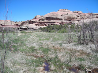
We were hiking by 9:30. It was very cool and we all started in long pants and sweat shirts. We didn’t need to drink as much or stop as often to rest. We hiked down for about an hour before it started to level off. After reaching the bottom we encountered something unusual, a marsh in the desert, complete with cat tails.
We enjoyed looking at Kirk’s cabin but kept asking, “How did he get that buckboard down here?” And “How did he get supplies from Moab?”

The trail takes you about as close as is practical to each of the “sights” including
· Pictograph on the right
· Stream/Spring
· Kirk’s Cabin
· Kirk’s Fence
· Anasazi Ruin on the right.
Views of Kirk’s Arch on the left.
· Extensive Anasazi Ruin (Big Ruin) on the left. Getting close is a bit of chore. Getting back is even more of a challenge due to the braided trails. “Did we come this way?”

· Anasazi Ruin on the right.
· Wedding Ring Arch on the right.

· Anasazi Ruin on the left. This one has self seeding squash going all the way back to the original Anasazi squash.
· Fisheye arch on the right.
 All American Man Pictograph with Anasazi Ruin on the right. It is hard to get a picture without climbing a little bit.

· Shortcut through a crack in the rocks. Watch for cairns on a tree branch.
· Four Faces Pictograph on the right.
· Stream/Spring
· Camp SC3.

We found the description in the Canyonlands National Park Favorite Jeep Roads and Hiking Trails book to be extremely accurate and helpful.

We knew from the weather posting at the Visitor Center that it was going to get down to freezing that night. Norm carried his tent just for this occasion. Jerry wore every piece of clothing he brought and slept under the stars.

Back to the Car (again) –Jerry’s bottle had ice in it and Norm’s Camelback didn’t work because there was ice in the tube. We enjoyed our coffee and Oatmeal. We started hiking at 7:15. We expected to reach SC1/2 near Kirk’s cabin at about 1:00 but since we had already seen all the sights and taken most of the pictures we reached SC1/2 at 9:45 with one break. We took a break there and topped off our bottles at the spring and were headed back across the marsh at 11:00. We found a shady spot in a dry creek bed for lunch. We reached the car at 2:00.

We had salad and steak or pizza in Moab. We then drove up to Arches where we had a reservation in the Devil’s Garden campground. We spent about 40 minutes in the visitor center and watched the movie. The drive to the campground required about a half hour. No showers but very clean rest rooms. Skyline Arch was within an easy walk of our camp site.

Arches – John went to see the Broken Arch and Tapestry Arch

while Norm and Jerry walked the Devil’s Garden Trail which begins with the 300 foot long Landscape Arch and then passes 6-7 other arches.

This trail requires hiking boots or at least good athletic shoes. Doing it in flip-flops would be a bad idea. There is quite a bit of scrambling and walking across angled surfaces. It was great fun especially with only day packs. We completed it in about 4 hours. Few people passed us.

We spent the afternoon driving back to Denver. Just 90 minutes before we arrived back in town there was a huge hail storm near our hotel. Six inches of hail fell, breaking car windshields and totally wrecking some cars. Glad we missed all that.


Thursday, October 1, 2009

Reid Lake Foot Travel Area

Resources – Backpacking in Michigan by Jim DuFresne University of Michigan Press
Map – http://www.fs.fed.us/r9/hmnf/pages/Recreation/huronshores/hs_reid_trail_map.pdf
Web Site – http://www.fs.fed.us/r9/hmnf/pages/Recreation/huronshores/hs_reid_trail_txtonly.pdf

Reid Lake Foot Travel Area includes over 9 miles of hiking trails. Almost all the trails are wide enough for side by side hiking. There is very little deadfall over which to crawl. The trails are marked as well as any I’ve ever hiked with ample blue diamonds along the trail and full trail maps at every trail intersection, complete with a nail marking the “you are here” spot. Each intersection is numbered and the sign posts have arrows directing you to the next numbers. The camping sites were nice, with fire rings, and every approved site had a toilet nearby. The RLFTA is a convenient 4 hours from the Detroit area. We took I75 north and split off to the east on US23 to Harrisville where we turned west on M72. The trailhead is clearly marked and is right off M72 about 19 miles from Harrisville. This trailhead includes a very clean outhouse. This trip was planned with a short lead time and little to no training was required. Trip was done by Norm and two sons, Paul and Marshall. Paul had done the trip before. We all had hiking boots but Paul had done it in athletic shoes in 2008. We hiked on September 25 – 27. The trees were just beginning to change colors.

Short Half – We arrived at the trail head and were walking by 3:15. Our objective was a campsite near Little Trout Lake, approximately 3.5 miles. The segment from point 1 to 8 was closed so we took the slightly longer route past points 2 and 7. Then we proceeded to points 9 and 10. This basically took us down the East side of RLFTA. The segment from 10 to 11 was closed but we walked that way anyway. We found that the dam that forms Little Trout Lake had been washed out. The nice wooden bridge was askew in the bottom of the canyon left by the washout. Based on the water marks on the trees, the lake was down about 8 feet. There was a narrow stream leaving what is left of the lake and flowing through the canyon. Previous hikers had bridged the stream with logs, so we proceeded across and on to the campsite just beyond point 11.

We arrived at the campsite at 5:15. We dipped water just at the log bridge and filtered it for dinner and breakfast. Ate freeze dried and played trivia until Norm started to get chilled and we all climbed into our sleeping bags. We had heard “normal” owl calls during dinner but after we turned in we also heard the blood curdling screech owl calls. They sound too much like a human screaming in serious pain, and make you question the wisdom of sleeping outdoors. We also thought we heard coyote yips at one point. We had no varmints invading our food even though we didn’t hang it.

Up to Reid Lake – We had oatmeal and freeze dried eggs for breakfast at about 8:30 and were walking by about 10:00. We proceeded south around to point 12 and then north to points 4 and 3 and then down towards point 6, approximately 4.5 miles. This took about 2:20 with one short break. The first mile after leaving camp was all up hill, although not very steep. This morning’s hike seemed to have more uphill than downhill. How does that work?

We set up in a nice large campsite on the south side of Reid Lake, overlooking the lake. There was another site just to the west which was occupied but we did not even hear the couple that was camping there. There are four docks on Reid Lake and one seemed to be occupied by a couple who just walked in the mile from the highway to fish for the day. We saw a few day hikers around the lake as well. After dinner Norm watched a beaver swim along the shore. We had freeze dried dinner and played trivia again. By 7:30 we started turning in. We heard the same variety of owl calls again tonight. No varmints at this campsite either.

Back Home – We arose about 8, packed and walked back to the car via points 7 and 2. The mile walk took us only about 20 minutes. We changed into clean clothes and drove into Harrisville where we had a wonderful breakfast. We were back home in time to watch the Lions or the weekly NASCAR race.

Friday, September 4, 2009

Grand Canyon Rim to Rim to Rim - Utah Flats, Phantom Creek

April 17 - 25, 1998

Note - This was our first attempt at Phantom Creek. We reached upper Phantom Creek but due to the flow rate we did not descend Phantom Creek. See Grand Canyon - Clear Creek and Phantom Creek For our descent of Phantom Creek in a subsequent trip.  In 2013 we repeated this trip including another successful descent of Phantom Creek.  The log from that trip includes more current trail conditions and better photos of the route to Utah Flats.

Friday – Getting to the Canyon - John drove. He and Jerry had time to get coffee, sweet rolls and still be early to pick Norm up. We arrived at the airport in plenty of time for our 9:40 flight only to learn it was delayed for one hour. Jerry checked his backpack and his travel bag so he had no glasses or book. Things were looking pretty grim. John luckily had an extra pair of reading glasses, and Jerry bought a newspaper. The flight was uneventful and included breakfast. John rented a Ford Taurus, which gave us just enough room by using half the back seat for luggage. We bought gas at a camping store in Phoenix and water and oranges at a Safeway in Flagstaff. We bought Subway sandwiches at a gas station and ate them outside (sitting on rocks; like we needed an extra meal on the rocks). As is our custom we reached the rim just as the sun set. We checked into Mather Campground, ate dinner at the Bright Angel Lodge dining room, and Norm bought a few more GC souvenirs. We slept better than we have on other trips but had to endure the motor home generator for a while and then a car alarm. We did not awake until 6 o’clock (9 by Michigan time).

Saturday – Down to the Bottom - It was COLD. Norm was happy he had gloves and all were happy to have stocking caps. We wore all the shirts and jackets we had with us. We fired up the stove for coffee and oatmeal to be sure it worked. We sorted through our stuff and repacked. We stopped by the Yavapi Cafeteria for coffee and then went to Mather Point to drink it and look over the S. Kaibab trail. We could see the trail clearly on and beyond Cedar Ridge, but we could not identify for sure how the trail got down to cedar Ridge. Did it stay high or not? We could see up the North Kaibab trail and had a good view of Utah Flats.

When we arrived at the trail head we learned that we would not be allowed to park; in fact we weren’t even supposed to drive up there. We quickly dropped Jerry and the packs off and went to find a parking place. A kind shuttle bus driver suggested a picnic ground nearby or the scenic overlooks nearby. The picnic lot was full and the scenic overlook lots looked too vulnerable so we went back to (yes, you guessed it) Yavapi Lodge to park. The shuttle bus picked us up and we were on the trail by 9:45. We did not hustle, as we were happy to be bringing up the rear to avoid a few more people. We have no history of catching up with people so it was a pretty safe approach. It was still brisk in the shade and there was ice on the puddles. The trail is wide and well prepared (for the mules). There seem to be some special cairns for (or by) the mules. They are green and aromatic. There were not as many as on the Bright Angel trail in May of 1994.

Our first OOPE (out of pack experience) was at the rest rooms on Cedar Ridge. This was quite short as there were about 100 people and 2 dozen mules. We stopped for a longer stop in the shade below O’Neil Butte. By the time we got to the Red Wall descent, we were in the full sun and the next shade was the rest room on the Tonto platform. John and Norm were not excited about the ambience but were happy to have the shade. As we ate lunch we were visited by our first ever backcountry ranger. It was Todd Van Something, who was also the Cottonwood ranger. He checked our permit and assured us we would see him again. (On six other backpacking trips we had never had a ranger check our permit.) We saw some raggedy looking squirrels. They needed to polish their begging technique if they were going to get fat and bushy like the Bright Angel Squirrels.

The trail is only on the Tonto for about 50 yards and then descends into the Tapeats. As it crossed the Tonto trail we were happy we were going down and not "across” on the Tonto trail like the group we saw. We were surprised to meet people who were coming up as we descended this lower part of the trail so late in the day. We expected this section would have been clear of people coming up by 9 or 10. We particularly noticed Mr. Sweats who had on shorts over sweat pants and was using a very slow deliberate step even in the lowest and earliest (for him) parts of the trail. The other people we felt for were a couple. The young woman had dropped her pack to go back and help the fellow. He had shorts and was carrying too much weight on himself (not in a pack). It was not at all obvious that they would make it by dark and they had no equipment to sleep on the trail. We stopped in the Schist but did not eat.

We crossed the black bridge at 3:30. 5 hours and 45 minutes to descend the 6 miles. Norm’s toes were feeling pretty jammed into his boots. After finding a site along the BA creek Jerry cooked mashed potatoes and roast beef gravy. It was from the 1996 trip but cooked up and tasted fine. After dinner Jerry made the blackberry cobbler. It was Ok at best but at least he wouldn’t have to carry it further. Jerry picked it out for the 1997 trip and Norm carried it for 7 days. After dinner we walked to and John and Norm crossed the Silver Bridge. Jerry was not interested in walking on this bridge since you can see through the grating all the way down to the river. This completed Norm’s goal of crossing the suspension bridges at the bottom of the Grand Canyon. While we were near the river we saw a Big Orange Jeep (Big Horned Sheep) high up across the river. We also looked around Phantom Ranch. After dark we played a little Trivia, getting 6 of 6 right in the first few pages, and went to sleep under the stars. It was cold enough Norm was literally shivering, and had to mummify himself.

Sunday – Up to Cottonwood – Jerry awoke feeling poorly so he went back to sleep. John and Norm walked to the ranger station to get trip tips on the Phantom Creek route. They learned that Phantom creek required wading in waist to chest deep water to cross the pools. Harvey and George hadn’t mentioned exactly that. We started to consider the Tonto route. The ranger advised that going up Phantom creek wasn’t much fun even at low water, but in the spring would be a real drag. When they got back to the campsite they found Jerry still asleep, so they read, and enjoyed the Canyon a little longer. Jerry eventually awoke and felt a little better but still couldn’t keep much food down. As Jerry packed up, Norm read Psalm 91. Jan always writes that on the GORP bags to remind us. By about 10:15 he felt good enough to leave for Cottonwood. We saw only one party going up, and eventually saw 4 parties coming down from Ribbon Falls; a total of about 22 people. The trail is quite gradual and is pretty smooth and wide. The major excuse for having this piece of trail in such great condition is that the water line is underneath it. We stopped four times in the shade of the overhang or other rocks, had lunch. John commented that Norm always seems to find a place to sit where he can lean back. We arrived at Ribbon Falls at about 3pm. We spent quite a bit of time at the falls and took some pictures that turned out very well. It is a beautiful spot. We climbed up behind the falls and watched the water hit the big mound. We then arrived at Cottonwood Camp at about 5pm. Ranger Todd recommended Site number 4, and he was right. We moved up to number 4. It was a little further from the other occupied sites, was the right size for 2 small tents, had a nice view, and was far enough from the whine of the water system that we could not hear it. Unfortunately even site number 4 had the gnats. We finished eating just as the sun set, and played Trivia by flashlight. We again got 6 out of 6 almost right away but played on anyway. We slept in tents, because it was a little cooler at the higher elevation.

Monday – On to the North Rim - We were on the trail by 7am without packs. We made good time and stopped less frequently for shorter periods than we do with the packs. Roaring Springs is spectacular. There are actually about 5 different springs gushing out along the north wall of Roaring Springs Canyon. They all cascade down hundreds of feet. This is where the water lines to both rims originate. From Roaring Springs, North, the trail is used for Mule trips but since we were there before the North Rim opened, there were no Mule cairns to avoid. It seemed pretty wide to Norm but pretty narrow to Jerry. To control erosion and run off, there are many diversion devices, of wood or stone. The mules must be very sure footed to cross all these without stumbling. The most memorable stretch (for John and Norm) is in the Muav and Redwall. It is a trail with hundreds of feet of wall on one side and hundreds of feet of fall on the other. Jerry said he just watched the corner where the wall met the trail and the feet in front of him. Norm and John greatly enjoyed the view across the canyon. Due to the snow melt above there were about 6 little waterfalls which came down near or directly on the trail. This was another day when we got to see active waterfalls where the summer crowd would just see rock. We could see them originate hundreds of feet up and cascade down through several shelves and falls. In the morning we did not get too wet even when the water fell right on the trail, but on the way down after the sun had increased the melt rate, we got quite wet a couple of times. We were happy the air was warm. We wanted to rush through to keep from getting drenched but we had to go slowly because the trail was right on the edge of the abyss and the wet rock could have been slippery.

There are some landmarks on the map that kept us apprised of our position and progress: the bridge, the tunnel… We stopped for a longer rest just after the tunnel. We soon found our first snow on the trail. It was in intermittent stretches of 10 to 100 yards but was at least 3 feet deep. There were footprints of two other people who had packed a trail, so we did not “Post Hole” too much. The snow was continuous through the Hermit Shale, and was intermittent in the Coconino at the beginning. By the top of the Coconino it was uninterrupted and stayed so all the way to the North Rim. The ranger had said that he talked to only one person who had tried for the North Rim this year and had been turned back by deep snow. We thought perhaps we would be turned back too, or perhaps we would be the first of the season to make it? We could make out tracks from two different boot treads in the mud, and they both went in both directions. These tracks made it all the way to the rim and so we followed them. There were two snowballs at the top, perhaps made by the two hikers. It felt great to be the second party of the season to make the rim, and to be on the North Rim all alone. We joked about a ranger asking us where our car was parked and telling him it was parked on the South Rim. The only ground not covered with three feet of snow was a single lane of road. We sat in the road, ate lunch and napped with our heads on our canteen pillows. We were sweating even though there was snow on the ground but after cooling down, we started to get uncomfortable when the sun was covered by clouds.

After lunch Jerry lead the way down. The snow was warmer, slipperier, and we ended up doing some post holing. We all ran out of water so filtered some just above the tunnel where we rested again. Norm used a zip lock bag to catch the water and Jerry pumped. This water lasted us down to the residence of the pumping station engineer. He has a sign inviting hikers to get water and in the summer often has lemonade. He came out and talked to us for about 15 minutes. He has been there since 1972, raised three children there and can’t image anywhere better to live. He said the park runs a helicopter shuttle weekly to supply him and the campgrounds. That station pumps only to the North rim, so he leaves in the winter and lives near the south rim. The water is carried by gravity to Indian Gardens on the South side where there is another pumping station for the South Rim. The pumping station engineer was the only person we saw all day.

We arrived back at camp at 5:30 (14 Miles). We were enjoying the out of pack day and decided to ask to stay at Cottonwood an extra day and give up a day near Phantom Creek. We had Chicken Stew, which was the best meal of the trip. As the sun was setting we watched the parade of jets and vapor trails criss-crossing the canyon. John guessed at their destinations. We talked about alternatives for our extra layover day, and decided on visiting the Transept, which Harvey recommended. It would require a crossing of Bright Angel Creek but we had crossed creeks before. We got 6 of 6 in Trivia quickly yet again but played until 8:35 which is pretty late for us.

Tuesday – Wall Creek – Ranger Todd was had not shown up around camp, so we decided to leave him a note asking permission to stay the extra night. Only three other sites were occupied and they would probably return to Bright Angel Camp again that day. We walked up and down Bright Angle Creek to find a good crossing point to get into the Transept. The flow was stronger than we really wanted to cross so we decided to go down to Wall Creek and explore there, since it was on our (the East) side of the Bright Angel Creek.

Walking up Wall creek was like walking up Shinimo in Merlin’s Abyss. There was no trail and we crossed the creek several times and walked through brush, bushes, branches, ankle biters, and avoided cactus. We stopped for snacks in several pretty places. Jerry left his T-shirt in the first one under some cottonwood trees, since the day was warming up. We were sure to see it on the way back, and we had to come back that way. We next found a beautiful 12 foot waterfall, then a quartzite alcove half bowl, then some huge cottonwood fallen trees which served as nice seats for serious lunch. Norm had smoked trout that was heavenly after canned chicken. On the way down to the mouth of Wall creek we walked back up a water shed up to a steep seep which was shaded and cool. As usual it did not seem possible to find our exact route again. Jerry lead and by hugging the north side of the water shed we made great time and found ourselves back at the North Kiabab trail. But the new efficient trail did not take us by Jerry’s shirt so back up we went to find it. Since we were not sight seeing, it did not take too long and we used the north side route to finish up quickly. It was still a mile or more back to camp and we were out of water since we had not brought the filter.

When we arrived back at Cottonwood camp we were plenty thirsty and tired. Our site was not shaded so we flopped down in one of the group sites near the water spicket. We chatted with a fellow from Wisconsin who was with his wife and son on their third or fourth trip; always down Bright Angel. He had packed in the Smokies in spring and told of sharing shelters packed shoulder to shoulder with “through” Appalachian Trail hikers. The shade was great and we were ready for a nap, but the flies made it impossible. Norm went to sleep in his hot but fly free tent, and then went down to cool off in the creek. John and Jerry joined him. We had Richmoor Lasagna. It was OK. We studied the maps and talked quite a bit about the Phantom Creek route, and although the enthusiasm was limited we decided to do it as planned, that is go up Phantom Creek. Played trivia by flashlight again but never got 6 of 6 correct. It was about here that Jane Fonda seemed like the correct answer to most movie-related questions. Jane Fonda was never correct.

Wednesday – Phantom Creek? No, Utah Flats – We hit the trail about 7:15 which was pretty early for us on this trip. We quickly noticed the difference of being back in packs again. Being down four day’s food didn’t seem to make much difference. Since we knew we would be near the creek, we did not even have full loads of water. It could have been (and soon would be) worse. When we got to Wall Creek we noticed the flow was much heavier than it had been when we came up to Cottonwood. It was so strong that the carefully selected and placed stepping stones were totally covered with water which was so clouded with sediment that we could not find the stones. Norm just waded across, and Jerry and John followed suit. We knew we would get our feet wet down at Phantom anyway. It was about there that we started to see how much higher Bright Angel Creek was, and how clouded it had become. When we got to the Ribbon Falls bridge, Norm stopped to talk about the plan. He suggested that we had some new valuable information: the warm temperatures had just about doubled the flow rate in the creeks we had come to know a little, and so the flow in Phantom would probably be double too. John quickly got consensus that we did not want to attempt the stock trail over the Tonto route to Phantom, and so we decided to go down to Bright Angel Camp, rest until near sunset and then climb up to Utah Flats. We took a long break at the mouth of Phantom Creek but no one seemed tempted to cross and hike up. The rangers had said that hiking up was a drag in low water. This would be much worse. We arrived at Phantom Ranch at about 11:30. Norm offered to buy Cokes. Jerry thought Phantom was exclusively for the Mule riders but Norm convinced him we were welcome. Norm bought Iced Teas and we browsed through old Grand Canyon books from their reading collection. When we couldn’t hang around there any longer we checked with the ranger to see if there was an opening at the camp ground. There was not but ranger Shore was in, and he gave us some advice about getting up to Utah flats and down to Phantom Creek. He said “You will wonder why you are staying high so long when you can see Phantom Creek for so long.” We found shady spots and enjoyed napping or soaking our feet in the creek.

By about 3:30 it was getting shady on the hillside even though it was 100 degrees in the sun. We started up, with full loads of water. The trail was steep but it was loose. We followed the trail up to the rounded rock Shore had pointed out. We found the trail up to the cliff that most people climb and also found the trail around to the right and up which Shore had told us about. Norm was exhilarated by the climb and the route finding through Piano Alley. There were hundreds of sandstone pianos to climb over, around, and through. After about an hour and a half we were up in the opening to Utah Flats. The Supergroup Dox Sandstone is smoothed into rounded but huge blobs that are stacked up like steps. They are so big and smooth that you can not climb up in most places. We did find a way up and onto a more soft and level shaley spot where we set up camp. There was one rock for the stove and about 25 feet away there were some rocks to sit on (the dining room). As we were unpacking our stuff the sun was over a hill, so we were in shade but the pinnacles to the east were afire with the sunset. Norm noted how blessed we were to be in such a place at such a time. Someone broke out more Pringles. There was no shelter there but there was also no wind and it was perfectly clear. Jerry cooked Mountain House Chicken a la King and corn. It was OK. Norm could not finish his and had to carry out the rest. Too many Pringles spoiled his dinner? (Six days is about when Norm gets tired of freeze dried every year.) We slept under the stars and watched for satellites and planes. There were many.

Thursday – Phantom Creek – We got going at about 8; not too far to go, so no big hurry. George Steck’s book says he could not find a trail across the flats, and neither could we. We had never seen such a dense patch of cactus as on the plateau between the exposed sandstone sections. If yesterday was Piano alley, this was cactus alley. We stayed to the right of the blister of sandstone on the slope and as we crested the slope we could see trail below us and off to the left. It came out of the first water shed we would have to contour into. Once we picked up the trail it was pretty easy to follow, although there are precious few cairns. It stayed at about the same level for quite a while. Ranger Shore said we would wonder why we were staying high so long. We did. At about 9:30, on the north side of the water shed, Jerry (as usual) found shade in the desert, in a shale alcove. It was welcome. Almost immediately after the alcove we found ourselves on a loose, steep descent to the creek.

As soon as we got to the creek we got a bucket of water and set it aside to settle. Norm was out of water and John and Jerry were low. Jerry found a nice shaded spot under a rock overhang right next to the creek. We lounged a little. We had read about the waterfall, and John had struggled to figure out where it would be on the map, so we wanted to see it. We knew from Ranger Shore it must be just down the creek from our position. We made our way down stream but got cliffed out and had to cross and recross. We found one of the sheltered camp spots on the north side of the creek. The creek was running so high we could not get to the good vantage point to see the falls from above so gave up and went back to the shady spot for lunch. We filtered some water but Jerry had to clean the silt our several times for just a canteen and a bottle. We hoped that above the confluence of Phantom and Haunted, one of them would be cleaner and so we headed upstream to find a campsite and cleaner water.

Soon we saw signs of the other party whose permit allowed them to be in the Phantom Creek use area. There was one fellow at the campsite and he directed us to some pools they had been using to filter water. They were next to the creek but were seep pools and so were not as silty. We got all the canteens and some bottles filled and then the creek level rose a few inches and flooded the pools with silty water. Norm went up stream while Jerry and John worked on the water. He found a nice sheltered campsite and lead John and Jerry to it. We explored little and relaxed for the rest of the afternoon. Jerry found a clear pool next to the creek for filtering water. As we relaxed the rest of the other party came by. They had been up to the source for Phantom Creek and told about a cairned trail up through the Redwall to Diva Temple. They had not taken it and seemed about as likely to as we would be (very unlikely). The wind was quite gusty that afternoon and evening. It would seem to build up steam and then pour into our “cave”. Jerry thought it was all blowing right down his sleeping bag. Norm had to get the sand out of his hair and ears and teeth in the morning. We played Trivia down by the creek and Jerry shared his Italian Salty Snacks. We played until after dark but did not get 6 of 6 this night.

Friday – Phantom Creek & Back up to Utah Flats – We had the morning to explore and sight see. We headed up the trail, up Phantom Creek. Haunted Creek comes in from the North, and above the confluence Phantom was cleaner. Jerry and John bathed and we all relaxed at a wide spot in the creek. When we got hungry for lunch we headed back to camp, ate by the creek, took a nap, and filled up all our canteens and bottles to prepare for the night’s dry camp on the Flats. We did not want to be up on the flats in the afternoon sun so we timed our departure to get us up there about the time the sun went behind the hills. Even though the packs had only 2 days food, they still felt heavy with all the necessary water. It was gusty again but as we went through the other party’s campsite it was like a wind tunnel. They were in a very narrow spot with rock walls on both sides, so it was probably worst there. They said we would be blown off the Flats. The climb up to the Tonto was not as bad as the descent. The footing is better going up than coming down. You don’t have gravity fighting you for control. Norm was relieved when the steep climb was over. We were surprised at how short the ascent seemed compared to our memory of the descent. It took us back to the shale alcove and we took another break there. The rest was basically contouring through the watersheds and it was basically up and down in small increments. We lost the trail at about the same spot we had found it. Jerry led us back to the campsite and although we stayed a little higher, it was about the same route we had taken the day before. John tried to tell us about a ledge we had to descend but Jerry and Norm were sure there was no such ledge. John said “OK, fine, see you in camp”, and then Jerry and Norm found the ledge. John always has the best trail memory. There is little point in arguing with him. We arrived in camp at about 5, and made good time with few stops. It was still a little windy but as the evening came on the wind died down. We had Chicken & Noodles which was better than the Chicken a la King. Jerry started falling asleep during Trivia so we had to wake him up to get his expertise. Tomorrow would be a tough day so we agreed that anytime after 5am, whoever woke up first should wake the others. We slept under the stars again, although it was more overcast.

Saturday – Bright Angel Camp and Back to the South Rim – Jerry was first to wake and got us up. We were walking across Utah Flats by 6. John’s great trail memory got us down to Piano Alley where we picked up the trail. It was looser going down than it had been coming up so it took great care. Norm ripped another big hole (2 actually) into another pair of old pants. We arrived at Bright Angel Camp by 7:40. We dumped our stuff in a campsite next to the wash room, changed into shorts, and used the facilities to clean up. Norm rinsed out his short sleeved shirt and then put it on wet. Before ascending the South Kaibab trail we stopped at Phantom Ranch for a second cup of coffee. A little civilization is not all bad. John let Ranger Shore know we were safe and sound and that neither Phantom Creek party had gone up or down the creek. We headed up the trail at 9, which made us about the last party to start up. The only others were hiking up from a boat party. One of the women had a huge pack which even had a life jacket strapped to the side. The overcast from the night before stuck around so it was cooler than it had been and the sun was not as oppressive. There was even a breeze. We had planned our water to have the canteens last to the Tonto plateau, the first bottle to the top of the Redwall, and the last bottle to get us to the rim. On the Tonto, we topped off our canteens and dumped out the remainder of the first bottle. We met dozens of people coming down, few with full packs. The real exceptions were three women older than we who had full packs and all three had a ski pole in each hand. John and Norm had joked about the ski pole hikers, but for these ladies we were all admiration! Several people asked if we were coming all the way up from Bright Angel. A few times we tried to explain that we started from Utah flats or at the Tonto elevation on the North side. No one understood, so we gave up and just said yes. We did get across to a few that we had been down for a week, not just overnight. A few even understood we had been all the way to the North Rim.

We did not rush the pace and we all felt the exertion but we stopped infrequently and for pretty short periods, so we made pretty good time. We had lunch after climbing up the Muav and Redwall switchbacks, on the narrow saddle that leads to the Supai. The overcast reduced the need for shade so we just sat out next to the trail. All Jerry had left to eat was some tuna. Norm had chicken but was so tired of it that he swapped with Jerry for some beef jerky. We topped off the canteens again and dumped out more of the excess. The next OOPE was at Cedar Ridge. Jerry had not liked being there among all the people on the way down, but Norm refused to go any further without a rest. At that time of day all the mules were gone and the people were pretty dispersed. Norm got strained stares from a young girl who was on a day hike with her family. He guessed 8 days below the rim must make you look pretty interesting; 8 days of beard, little washing, plenty of scrapes and scratches and clothes which have been soaked through a couple of times. (She really would have loved the pants he split!) During the final climb through the Coconino a couple observed our big packs and asked John if he would recommend it. They chuckled when he said, Yes!

We rimmed out at 2:40 which meant we had climbed out in about the same time it took us to descend. Not bad for 50 year old gents. The shuttle bus was idling so we hustled to get on. It was already full and we had to stand WITH OUR PACKS ON. No one offered a seat. Another young woman stared to ask Norm a question but when she got a good look, she stopped short and said “Never Mind”. Boy, how bad could he have looked? He’d even changed his shirt by this time. An adult fellow did engage John in a chat about our adventure.

We cleaned up at the Mather Campground Showers, ate dinner at the Sizzler in Flagstaff, and arrived in Phoenix at about 9PM.

Monday, August 24, 2009

Canyonlands, Needles District, Utah

Planned for spring 2010


Resources

  • Canyon Hiking Guide to the Colorado Plateau by Michael R. Kelsey, Kelsey Publishing Provo UT
  • Utah’s Incredible Backcountry Trails by David Day, Rincon Publishing Orem UT
  • Canyonlands National Park Favorite Jeep Roads & Hiking Trails by David Day, Rincon Publishing Orem UT
  • Needles District Trails Illustrated Map, National Geographic
  • NPS Website - http://www.nps.gov/cany/index.htm
  • NPS Map - http://www.nps.gov/cany/planyourvisit/upload/tripmap.pdf


Following is a plan for our spring trip in 2010. If anyone has experience in this area and would like to make suggestions we would welcome them.

This will be broken into two separate loop hikes. We will move the car in between. The first part includes a loop of the Chesler Park area and then a larger loop down to the Colorado River, up the river to the Confluence with the Green, and then back to the car. Part 1 looks like four days for us. The second portion will be in upper Salt Creek. The car will be relocated to the Cathedral Butte area. We’ll hike north in the West Fork of Salt Creek, and back to the car in the main fork. Part 2 looks like 3 days. This plan omits hiking into the Big Springs, Lost Canyon and Squaw Canyon. We only have so many days.


Day 1

Drive the Car to Elephant Hill. Hike 2 miles to campsite EC1. Bring 1 extra gallon of water per person. Drop the packs. Day hike without packs down to Chesler Park via Chesler Park Loop Trail, jeep trails, and the Joint Trail. Depending on our feelings at this point, we could go down to see Druid Arch or not. Then back to EC1. Distance without packs: 7.5 to 11.1 Miles.

Day 2

Using that extra gallon of water we carried on day one, hike down to the Colorado River via Lower Red Lake Canyon Trail. Distance: 8.3 Miles.

Day 3

Hike down river without packs as desired. With packs, hike up the Colorado to the Confluence with the Green. Distance: at least 4 miles.

Day 4

Hike back to the car at Elephant Hill. Distance: 7.5 Miles. Shower. Camp at Squaw Flat.

Day 5

Drive the car to Cathedral Butte. Hike down into Salt Creek. Before reaching Kirk’s cabin, cross over to the West Fork. Hike North in the West Fork. Camp in the West Fork, near the confluence with the main fork. Get water from main fork if necessary. Distance: 8-10 Miles.

Day 6

Leave packs at junction with main fork of Salt Creek. Day hike up to Angel Arch. Come back. Pick up packs and hike down to campsite SC3. Distance: 9-11 Miles, 5 without packs.

Day 7

Hike back to the car in the main fork of Salk Creek. Distance 9 Miles. Drive back to Salt Lake City.

Saturday, July 11, 2009

Ozark Highlands Trail

NW Arkansas in the Ozark National Forest

Sections 7 & 8 plus the Buffalo River Trail


Resources – Ozark Highlands Trail Guide by Tim Ernst, Cloudland.net publishers

This is perhaps the best trail guide we have ever used. The maps were so complete that we did not buy a separate map. This is the only trip for which this is true. The map has distances between significant land marks.

Web - http://www.hikearkansas.com/oht_map.html


We flew into Springfield MO airport and drove south past Branson MO and through Harrison AR.


Shuttle was prearranged with

Buffalo River Outfitters.

Route 1, Box 56

St. Joe, Arkansas 72675

Phone:870-439-2244, 1-800-582-2244

http://www.buffaloriveroutfitters.com/


Shuttle And Half Day Hike31 March 2006 – Breakfast at the stone bakery in Harrison. Wonderful cinnamon/pecan rolls with eggs. (Colton’s - Good steak house last night with peanut shells on the floor, etc.) Arrived at Buffalo River Outfitters about 8:45. Our shuttle driver was late so we played fetch with the dog. They had us put the car inside a fence to be safe. The shuttle driver was born and raised in the area. Her family owned property “down in that holler”. She dropped us off at Fairview Campground on Highway 7.

We were walking by noon. It rained lightly. We found the actual OHT after a few minutes of reviewing the book/map. This is a walk in the woods. We stopped on a fallen log for lunch and found our first ticks. Took a break next to a stream. Found more ticks. We saw a snake, a few squirrels but few birds today. We had done 5.5 miles by 4:30. We first stopped next to a small creek but Jerry walked on and found a nicer spot near a larger stream in Greenhaw Hollow.

We heard a 2 cycle motor vehicle, dogs and a shot was fired. Don’t know more than that but that was enough to fuel a few imagined scenarios. We ate a very good teriyaki steak with rice dinner. Jerry made a fire and we solved three 5 Minute Mysteries and answered 50 trivia questions. We wanted to sleep under the stars but we could feel the dew forming. We put our sleeping bags under or in plastic. Condensation formed and we had damp sleeping bags by morning.


To Falling Water Creek1 April 2006 – Cool when we awoke so not in much of a hurry to get going. Walking by 8:40. Today we saw wild turkey, squirrels and a family in a golf cart with three dogs. We crossed several two tracks and three roads. The afternoon was more rugged, less traveled and less well marked. The hike up from Richland Creek is steep and long. We could have trained a bit harder to get ready. We explored around the old CCC camp. There are still remains of some buildings. We saw a three foot black snake which got our attention. We then heard a strange squeak and followed it to find a frog being eaten by another snake. Survival of the fittest… The book uses the abbreviation SSS meaning Special Scenic Spot. We had our first SSS at the end of the day, a deep ravine with huge boulders. It was interesting to cross.

We ended at a river near a bridge where roads 1219 and 1205 cross Falling Water Creek. We found a nice level rock shelf jutting into the river. We made 9 miles today. Ate stroganoff for dinner but we could have eaten a bit more tonight. It rained twice during the night. Jerry joined Norm in the tent during the first rain. When it stopped he went back out. When it started again, he just put his sleeping bag and himself into a construction sized plastic bag. He had his rain jacket on already. The plastic bag on his pack blew off, so much of his stuff was damp. Having the tent on the rock turned out to be a poor idea since the water pooled around and under the tent.


Richland Creek Campground2 April 2006 - The sky cleared about 11am. The trail included several SSS. It was cloudy and misty so we didn’t get any good pictures. We reached the National Forest Campground by noon.

It had tables, a water pump and an outhouse. We planned to use the afternoon to visit the Twin Falls and/or Richland Falls. There is no trail and so we were constantly looking for the easiest walking. We crossed the creek one too many times and ended up stranded on the wrong side (the east side). We walked back to camp and cleaned up and napped. There was no other party within ear shot but we had seen a car-camping party in another part of the campground during our walk. We were visited by a skunk twice during the night. Norm shined it away with his flashlight. Slept under the stars. Got down to 50 degrees. It seemed colder.


Beyond Stack Rock Trailhead3 April 2006 – On the trail by 8:00. Cooler walking compared to yesterday. Got confused once by missing a turn off a jeep road. Recovered in about 10 minutes with only 100 yards of back tracking. This is the prettiest section so far. More boulders and little water falls. Took a climb up through the large boulders surrounding a stream. This morning we met Ed and his friend. They were doing trail maintenance. Ed had a chain saw over his shoulder looking for dead fall across the trail and his friend was nailing up metal “blazes”. Ed informed us we were entering the section where the “problem” bears are released. Great. Just what we wanted to hear. Ed’s friend said he had never seen an Arkansas bear that did anything but run away. That was more in line with what we wanted to hear.

We had been expecting dogwoods in bloom. Saw our first today. Also saw thousands of trillium just about to open up. Saw lots of May Apples. We got confused once in the afternoon. On a jeep road we got to a place where the road goes left and right. Fortunately we guessed which way to go correctly and double luckily the trail crossed our road. I believe we should have left the road onto a trail sooner. Originally we intended to stop at Stack Rock but there is no water, so we went on about a mile and found the best spot of the trip. Water down the hill to the right and the foundation and chimney to an old cabin to the left. We were done for the day at about 4:30. We could see smoke rising through the trees in the direction we would be going the next day. Not what we wanted to see. We had beef stew for dinner. It was pretty good. We solved all three of the mysteries we tried. It got down to about 40 degrees. Jerry slept out by the fire.


To the Buffalo River4 April 2006 – Cold. On the trail by 8:40. Unremarkable morning. Saw deer after lunch. We took a break by a creek. It was green on one side and burned on the other side. Our trail went right through the burned part. We proceeded with caution and wondered if we would be turned back at some point. We saw some smoldering logs so deduced the fire had been there within a day or two. A single tree was still burning and fell after we passed it. It got smoky and the smoke got thicker and thicker. Eventually we could see the edge of the burn up ahead. Fortunately, the fire was really only burning the dead leaves and so we just crossed the line of small flames and proceeded up the trail. The trail lead away from the active burn but we saw burned patches throughout the rest of the day.

We reached the last source of water for this stretch of trail much too early to stop so we decided to press on to the Buffalo River. This required five more miles of walking. It was on a jeep road, so the walking was relatively easy and level. Portions were even shady. There was a huge pasture on one side. It was a pretty pleasant walk.We made decent time but Norm ran out of water. The final event of the day was to cross Richland Creek. We reached it where it intersects with the Buffalo River, so the creek was backed up and looked deep. Perhaps we could have walked upstream a half mile but it would have been bushwhacking so we just walked straight across. Norm took a trial walk. It was about chest deep but the bottom was reasonably firm and smooth. There was little current at that point. We just carried our packs above our heads and walked across. The water temperature was refreshing but not too cold. We definitely wanted to do this in the heat of the day rather than tomorrow morning, so we camped on the far side. The shore was very soft dirt but not quite mud. It wasn’t the greatest site but it was OK. Shaved and cleaned up. Spaghetti for dinner. The Mystery stumped us tonight.


Buffalo River Trail5 April 2006 – When we crossed Richland Creek yesterday, we technically left the Ozark Highlands Trail. Continuing on the OHT would require crossing the Buffalo River somehow which would definitely require a boat. The Buffalo River Trail took us directly back towards our car at the canoe livery.

We heard thunder soon after we awoke. We hustled to get all our stuff packed so it would stay dry. The rain started before Norm could get his long johns off. Fortunately, at least, he had slept in his rain pants. We put our slickers on and covered our packs with plastic bags and ate breakfast standing in the rain. The rain stopped for about 20 minutes, just long enough to take a nature call and then we headed up the trail. I do mean up. The trail immediately heads up the side of the bluff on some wooden steps and hugs the side of the bluff for miles. It started raining again. We stopped only briefly and we didn’t even snack or take pictures. When it’s raining, the only thing left to do is just walk. There were some nice views back down to the Buffalo River. We could see large parties of canoers who were camped on the far side of the river. It rained until about noon. Some of the trail is quite beat up by horse traffic and there is quite a bit of hiking on normal roads. There is some color coding on these trail markings. We followed yellow or if both marks were in evidence we followed white. We referenced the book frequently. At one point the book and the marks clearly disagreed. We followed the marks. They lead to a small cemetery. It had stopped raining at that point, so we took our packs off and hung them on the cemetery fence and had lunch. Everything was wet so we didn’t even sit down. After lunch we found out that following the marks had given us a bit of a shortcut and then we were back in agreement with the book again. Rained again in the afternoon for about an hour. We had expected to find water in a creek at about 6 miles but that creek was dry. The next creek bed had small pools of rain water. We anticipated a dry camp so we filled all of our bottles. It stopped raining at about 3:30 and since we had not taken many breaks, we had enough miles in, but we just couldn’t find a decent camping spot. At 11+ miles we found a marginal flat spot off a side road. We were just north of Calf Creek. There was a pond nearby but the water didn’t look clean enough for us to wash up. The sun came out so we hung everything out to dry.

After dinner we tried the 5 Minute Mysteries again. First one stumped us but we got the second one. Norm got so cold he just wanted to get into his sleeping bag. Strangely, it seemed to get warmed through the night and we both took off layers of clothes. We heard owls and coyotes.


Back to the Car6 April 2006 – Due to the long day yesterday, we were not very far from the car. We were awakened by thunder. Again we hustled to get all of our stuff packed to keep it dry. This time it did not rain. The trail markers took us into some big hay fields. Then there was a fork in the trail and no marker. We backtracked but couldn’t find a marker right away. When we did find one it took us back to the road we had been on yesterday. We never figured out why any markers took us into the hay fields. After following the road for just a little ways we found the trail into Tyler Bend Recreation Area. There is a nice sign at that point. We were very early so we took some trails in the Recreation Area and visited the visitor center. At an overlook we could clearly see down into the hay fields. We laughed the the locals had put the confusing markings on the trails just so they could watch hapless out-of-state hikers wander around in those hay fields. Even though the road would have been shorter we took the trails all the way to the bridge and then walked up the highway the 1.2 miles of hill to the outfitter and our car.

Under the category of “nothing is ever easy” we found a sign on the door. “Went to St. Joe” with a phone number. No one was there and our car was locked inside the fence. We had no cell phone so Jerry walked back down the hill a hundred yards to another outfitter/store and called the number from the sign. No answer. The fellow at the store figured out what Jerry was trying to do, knew where our guy was and suggested a different phone number. Jerry got through on this number and our guy was back by the time Jerry walked back. We had lunch at Colton’s in Harrison, and got a room at Big Cedar Lodge (a Bass Pro Shop fishing theme park), about the only place to lodge between Harriosn AR and Branson, MO.