203 miles
Commonly done by staying in Bed & Breakfasts with commercial support to carry bags from B&B to B&B. Camping is available and some villages have youth hostels.
Our hike took 19 days with one full day and one half day off (Sept 1 through Sept 19, 2015). The hike is often done in 12-14 days by younger folks.

The Coast to Coast walk is unlike anything I know of in America. Centuries ago England defined public footpaths and public bridle paths which crossed through active farms and other privately owned land.

They have maintained these paths up the the current day. The Coast to Coast Walk was first documented by Alfred Wainwright in 1965 in a book by that title. It was Mr. Wainwright's vision to cross from the Irish Sea to the North Sea via pubic rights of way. With a few refinements, this is now possible and it is built upon the public paths, which pass through countless pastures that are occupied by sheep, cattle, and horses. The paths cross through farm yards, between the buildings that are in active use. In most cases the entry into the fields is facilitated by a variety of small walker gates and stiles, but in many cases the walker uses the same full sized gates that the farmer uses to access the fields.


 |
| Kissing Gate |
Although 10,000 people per year walk the Coast to Coast, it is not a recognized government trail, consequently the signage is quite incomplete. No more than 25% of the signs that mark the way actually say anything about the Coast to Coast Walk. Completing this walk absolutely requires a book. Expect to reference the book several times each day. I recommend Henry Stedman's Coast to Coast Path. It contains very detailed maps with turn by turn diagrams, thousands of landmarks and locations of many of the accommodations you will be longing to find at the end of each day.

The Steadman book does not have "big picture" maps. These may be helpful to find off trail accommodations, short cuts, or recovery routes should you stray from the primary path. You may acquire English Ordnance Survey maps via www.ordnancesurvey.co.uk or you might obtain the Coast to Coast A-Z Adventure Atlas. We started our walk with Martin Wainwright's The Coast to Coast Walk. It had helpful "big picture" maps but the detailed instructions are all in paragraph form. It is easy to loose track of where you are on the map versus where you are in the text. We obtained a copy of Steadman's book mid trip, and used both books for varying purposes. The books disagree on a few portions of the route.
You will need a compass or a GPS. We used our GPS every day, all day. We bought the Garmin Coast to Coast map package which gave us the equivalent of the Ordnance Survey maps in very small bits. To the maps we added a way points file from prior Coast to Coast hikes which was available on the internet. I wish I had started with the Steadman book and the way points that go with the book. The way points we had were very helpful on most days. If we took a path and it was leading to a way point we could be pretty confident we were "on the route." There are portions of the route with variations. On two days the way points took variations we did not wish to take. On those days we just relied on the book and the GPS maps. Many of our fellow hikers used their GPS devices as a last resort. I found it quite comforting to always know where we were 'on' the maps. When we did make a wrong turn, it was quickly evident from the GPS that we had done so and we would backtrack only short distances.
At the end of each day the GPS also let me determine how far we were from our B&B, which was quite helpful. On several days I created a way point for the night's B&B using GPS coordinates I obtained from Google Maps before the trip. In England, a mail code is a single address. Google Maps can pinpoint a B&B using the mail code and then it will yield the GPS Coordinates. Right click on the location, and select the What's Here option. For our Garmin GPS, I had to covert the format of the Google Maps GPS data via the http://www.earthpoint.us/Convert.aspx site.
We stayed in 7 actual B&B's and the other nights in hotels or pubs with rooms. We found every host to be very friendly and accommodating but found a little more personal attention in the B&B's. Almost all evening meals were obtained at a pub. In most of the Coast to Coast villages that is the only source of prepared food, and there is only one pub.

The ultimate accommodation would be the B&B that is within easy walking distance of the pub. We found a wide range of accommodations with the B&B's being nicer and a bit roomier. Every place we stayed had bath rooms attached to the bed room i.e. ensuite. It was interesting to see how they had accomplished what must have been a significant enhancement to many of these rooms. One extreme was the 6x6 bath with the 3x3 shower which required a 10 inch step up. The other extreme were the bathrooms with full bath tubs. In one case, they had used so much of the space for the bathroom that there was not enough room for us to open our suit cases in the bedroom. Norm opened his in the bath room and Bonnie opened hers in the entry way. She had to close it again when we left the room for meals. Then there was the room that was down hill on one side by a couple inches. We slept with our heads below our feet that night.
We used Sherpa Van to transport our bags each day. Sherpa had a 42 pound limit which we both met. If I had thought a bit harder, I might have realized I would be carrying the bags up and down the stairs every day. I would have set a much lower weight limit. We used Sherpa's connection transportation to get from the Darlington train station to Richmond and over to St. Bees and at the end from Robin Hood Bay back to Darlington station.
We used Sherpa's web site http://www.sherpavan.com/ for all of our planning. They have a list of all the villages that have accommodations on or near the route, with the distance of each from the start. I used this information to plan out the distance for each day based on our abilities. Once I had the basic plan, the Sherpa Van website has details on each B&B, Pub and Hotel in each village. Once I had made all of those selections, I turned the whole reservation task over to Sherpa. They made the reservations as requested unless there was no vacancy. They then tried for something else in that village or failing that, something in the nearest village available. In at least two situations they had to add miles to very long days due to unavailability of rooms. I recommend obtaining the Steadman book in the early stages of planning. You can use the maps to find the perfect B&B; the one that is on the route and next to the pub. Sherpa will also plan your whole trip if you just give them the number of days you wish to hike.
We found all of the English people to be friendly and helpful; B&B owners, bar tenders (who take your drink order, show you to your room, carry your bag (maybe) and later take your dinner order), servers, farmers and a few people who stopped their cars just to make sure we were enjoying our walk. On two occasions, we were standing in the rain with the book and the GPS out trying to select between two or three gates. In both cases farmers showed us the way without our asking. One was buzzing by on his 4x4 and stopped just long enough to say, "Go left". The other was in an enclosed tractor cab and I finally noticed him waving us in the correct direction.
The other important people were the other Coast to Coasters. Some we only saw once, if they were on a plan with more miles per day. But those with a plan similar to ours, we saw almost every day either on the trail or at the pub or perhaps even at the same B&B. It was great fun to get to know these folks and build comradery. "Did you take the high route or the low route?" "Did you go through the Abbey?" "How are your blisters?" "Do you need an elastic bandage?" "Do you know about the shortcut in the morning?" "If it's raining, we're taking the bus." We met Australians, Canadians, Americans, Germans, Dutch and, of course, many English who were all walking the Coast to Coast.
We enjoyed almost every meal we ate. The dinner menus were reasonably varied with some English specialties like steak and ale pie, and of course fish and chips. Everything comes with chips, even lasagna. Portions, including potatoes and vegetables, are huge. Full English Breakfast was always offered; eggs, bacon (ham to Americans), sausage, grilled tomato, mushrooms, toast, baked beans and black pudding. You can either tell them what to leave off, or tell them what from that list you would like. I got black pudding one morning because I forgot to tell the server to omit that. Some places offer variations, like poached eggs, beans on toast, or bacon sandwich. There is always a continental breakfast selection which you can have before or with the F.E.B; cold cereals, fruit, yogurt, porridge.
We had exceptional weather according to the local residents. Of the 20 days we were on the route, we had only four days with any rain, and a total of only about 10 hours. Just expect to have some rain and be prepared; waterproof boots, pants, ponchos or jackets and backpack covers. Keep your book and other maps, etc. in zip lock bags. Expect the GPS to get wet when you have to reference it. The rain wasn't awful. It was just a nuisance. If it had rained hard or been windy, it could have been miserable.
Cash can be an issue. Some of the B&B's did not accept credit cards. The Sherpa Van web site let us know which ones in advance. Most of the villages are too small to have a bank or even an ATM. We planned our cash and replenished our supply in Kerkby Stephan and Richmond. We did not use it, but there seems to be an ATM in Shap, as well.
We loved the Coast to Coast. We recommend it. Give yourself enough days to enjoy it.
And look both ways twice before crossing any street or road. It's just too easy to look the wrong way and step out...
Sept 1 St. Bees to Row Moor 9 miles
The Sherpa driver picked us up from the Old Brewery B&B in Richmond and delivered us to St. Bees. He provided some driving tips for Bonnie and interpreted some UK signs we had never seen before. He dropped us off near the Coast to Coast starting sign. We wet our boots in the Irish Sea and picked up our pebbles, one to toss into the North Sea and one to take home. We bought sandwiches at the restaurant above the beach. Norm had planned on only nine miles knowing we would have a late start.

We were passed by a couple dozen people, young and old, some with children. We never saw any of these people again so perhaps some were day hikers, and the rest on more aggressive schedules than ours. We enjoyed the 4 miles along the bluffs above the sea, but the path is quite worn-in and narrow, so it's easy to turn an ankle. We had lunch at a spot where the trail leaves the coast.


Once we left the coast, the trail followed narrow roads and paths.


Sept 2 Row Moor to Enderdale Bridge 7.88 miles
As we walked through Cleator, we encountered two talkative backpackers who we had seen at the pub. We paused a bit to see which way they were going, and followed them. They eventually disappeared but we caught up with them as they took a break. We then compared all our books, maps and GPS and determined we were slightly off course but hadn't actually gone out our way. We then headed up our first major climb of the trip; Dent Hill, a 1,000 foot climb.

There was a huge pile of stones on the top. Norm laughed that the English really didn't fool around when they built a cairn. The views were spectacular out to the Isle of Man.

The descent from Dent Hill is quite steep, down a rough gravel road. Steadman's map indicates this is "just about the steepest path on the whole trail." I must emphasize "just about." There are at least three that are even worse.


Our B&B hostess had convinced us we would reach Enderdale Bridge by lunch time so we did not carry a lunch. Wrong. We reached the Fox & Hounds pub planning to eat a late lunch at 3:00 but they had stopped serving lunch and wouldn't be serving dinner until 5:00. We each had an ale out on the picnic table overlooking a babbling brook. Bonnie does not like any kind of beer, so this was something of an event. After the ale, we walked on the Shepherd's Arms. Total Miles 17.

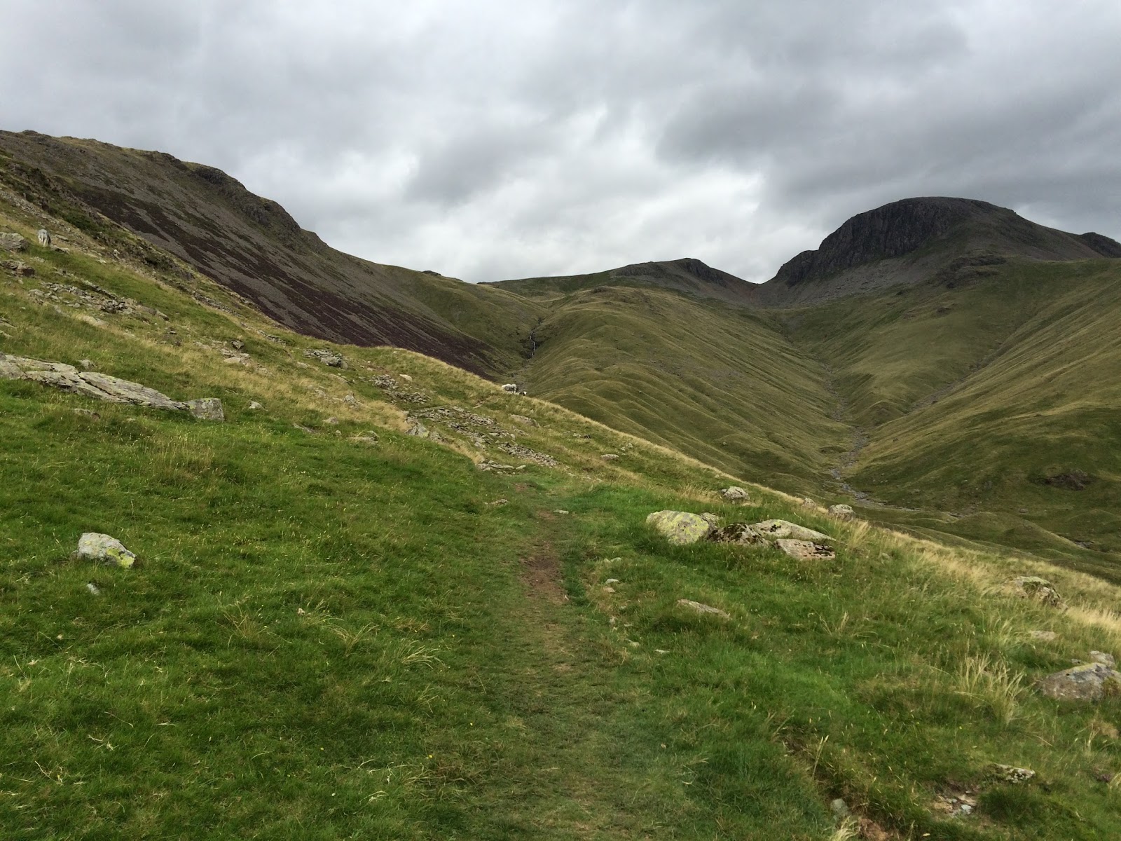
Sept 3 Enderdale Bridge to Rosthwaite 15.7 miles
This was the day we had trained for. We felt that if we could do this 15 mile day with all the elevation climbs, we could do the rest of the trip. We had trained, building up to 13 miles as our longest day in the midst of 4 consecutive hiking days.
In the morning we walked along the north side of Enderdale Water. The north side was a bit longer but had less demanding footing. Even so, there were about 100 yards of potential ankle twisting paths.


The path eventually joined a gravel jeep road with a nice gradual pitch. This lead to the Blacksail Youth Hostel which is nestled in the valley which was our introduction to the mountains of the Lake District.


We had a nice cup of tea at the cafe at the mine, and stayed on the road to the Royal Oak Hotel. We were the last guests to check in. Dinner was served for all guests at 7 PM. We had tasty roast beef with gravy and a puff of Yorkshire pudding. There were four other Coast to Coasters but most of the guests were non-walkers of a group who were having an annual reunion. We successfully completed the longest day before dinner was served. Total Miles 32.

Sept 4 Rosthwaite to Grasmere 9.5 miles
The trail started up gently for two miles and then became steep. We were passed by several people. At the steep part we were passed by a younger couple. They liked to hike in the Lakes District and were on a day hike. They had never done this particular hike. They had intended to hike up the valley and then back down but had changed their mind and were now hiking over the top and down the other side to Grasmere where they would catch a bus back to their car. It must be nice to have this variety of trails and this sort of transportation flexibility.


The trail has three options at this point. We eliminated the left route, which was the razor's edge ridge walk, called the Striding Edge. We eliminated the right route since it went up steeply. That left the middle route. About that moment the fellow from that young couple came back up the route we had selected. This is a bad sign. Seems he did not have his maps for the whole trip, was expecting 6 miles instead of 9 and thought, "it didn't look right." When we went over the maps in my book he saw that he was going right and we all started down. This is a rough rocky descent so each step required attention.

After a bit of a side track, we reached the Chestnut Villa, our B&B for two nights. We had a wonderful dinner at the nearby Swan. Total Miles 42.

Sept 5 Glasmere - Day Off
We enjoyed a bit of tourist shopping and then toured the Wordsworth Cabin and Museum. We enjoyed a welcome bowl of chili overlooking the river, and then took a nap before having dinner at the Traveler's Inn.


Sept 6 Glasmere to Patterdale 8 miles
We walked up the highway about 300 yards and rejoined the "official" Coast to Coast route. It climbs immediately. We took the left option. Footing was great. Steps were sort of worn into the grass. It seemed like it should have felt easier after our day off.

We passed a small lake and had lunch on the down hill side out of the wind.

We were entertained by fell bikers riding down trails we could barely walk. They carry the bikes up and then ride them back down. The descent into the valley includes many small waterfalls.


As we joined a jeep road we noticed activity across the valley. It seemed a mountain rescue team was aiding some people. We eventually passed three ambulances. We later learned that a young man had fallen while scaling a bit of a cliff. He had fallen on his hiking companion. The young man had a fractured leg but his companion was OK.

We arrived at the White Lion before 4 PM. At dinner we had a nice chat with an Australian woman who was doing four days of the Coast to Coast and then going to Wales to visit her brother. We also met a professional stone fence builder. He explained that the stones are everywhere, and then went on to lament how embarrassing is was to see fences with cement in them now days. He also knew why the sheep have different colors on their backs. It tells when they will lamb and which ram is the father. Total Miles 50.
 |
| Note the front door opens right into the road. |
Sept 7 Patterdale to Bampton Grange 14.2 miles
The first three miles were relatively level and then UP. We were actually above, looking down on, three RAF fighter jets as they practiced their technique flying through mountainous terrain. At the top of the first climb, there was some confusion among the other walkers and Norm lost his bearings for a bit. Bonnie waited patiently.

There is a beautiful lake on the top of the climb. That's why the call it the lake district, I guess.


This descent is the most rugged and one of the steepest of the trip. We had to plan every step. Bonnie had a problem with a toe on one foot and the opposite ankle, but once we got down to flatter ground she set a quick pace. The walk along the reservoir seemed to go on forever.


Just as we started out, one of the servers from the prior evening pulled in and pointed us to a shortcut that also avoided the road. We started out right through the church cemetery. The first 45 minutes involved several turns. Norm had the book out constantly.


Sept 9 Orton to Kirkby Stephan 12.76 Miles
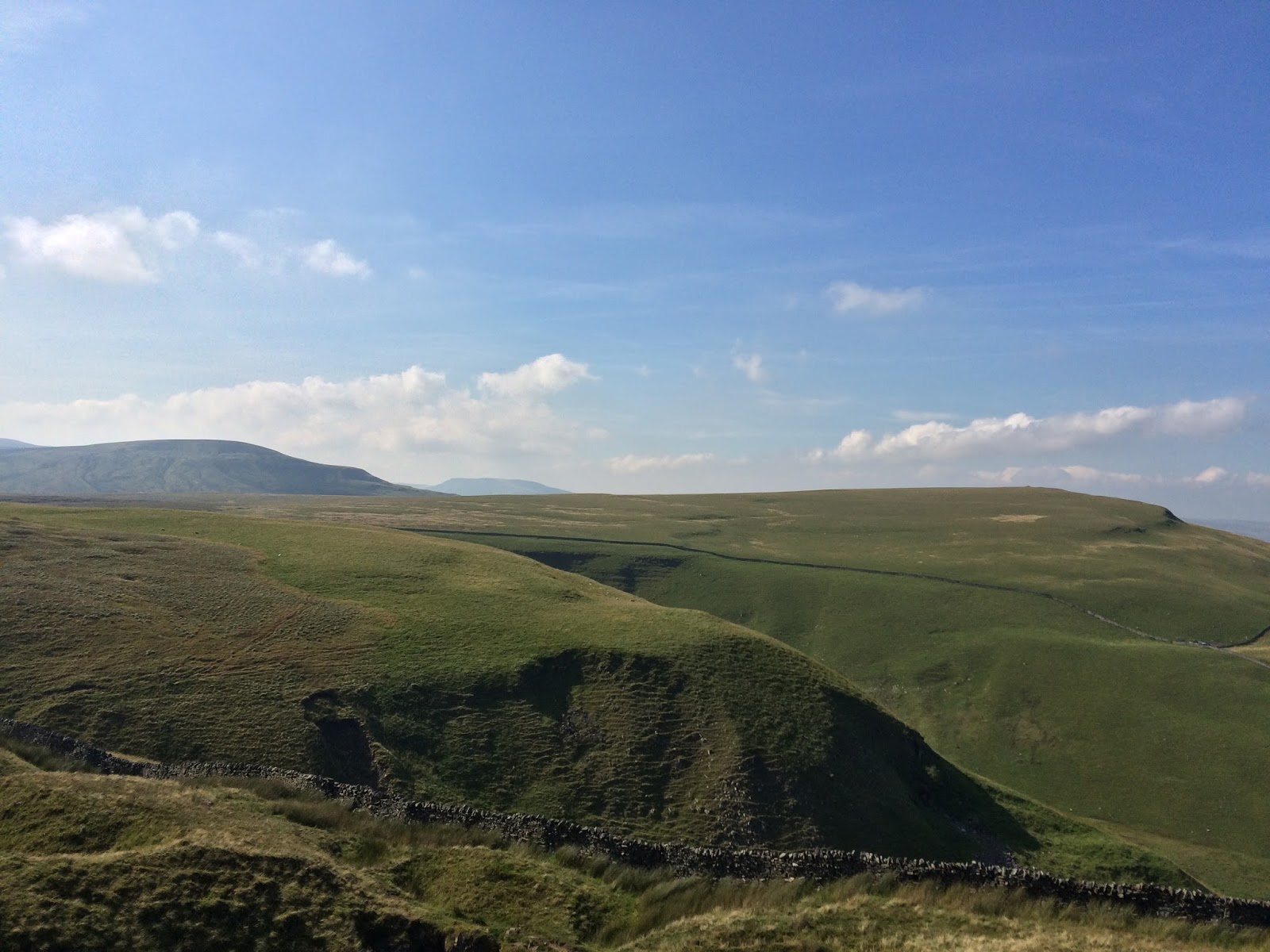
The terrain was just rolling. We followed miles of stone fences.


 |
| There has to be a story here. |
We arrived before the shops closed so Norm bought the Steadman guide book, which he had seen others using. A group of six Canadian walkers from Prince Edward Island shared a bottle of wine with us and regaled us with stories of PEI winters. This began an enjoyable and helpful friendship. For the first time on the trip, we did not eat in a pub. Kirkby Stephan is one of the few villages with a variety of restaurants. We had Chinese. Total Miles 91.
Sept 10 Kirkby Stephan to Keld 12 Miles
The route had three variations. The Red and Blue went up a 1,500 foot climb to the Nine Standards, ancient carefully crafted cairns. The books indicated that both Red and Blue were seriously boggy. We elected to avoid the climb and the bogs. We took the Green route, which was relatively level and only a little boggy.


When we arrived at the Keld Lodge we found our bags already up in our room. The lodge had booties to put over our muddy hiking boots, and a nice drying room for the boggy boots, the first such room we encountered. It was quite windy all day, and we learned that up at the Nine Standards people were using them as wind breaks more than historic attractions. Total Miles 102. Half Way.

Sept 11 Keld to Reeth 13.7 Miles


Today we walked atop a stone wall for about a mile. The fall on either side would have been six feet, but it was about two and a half feet wide, so it wasn't scary.


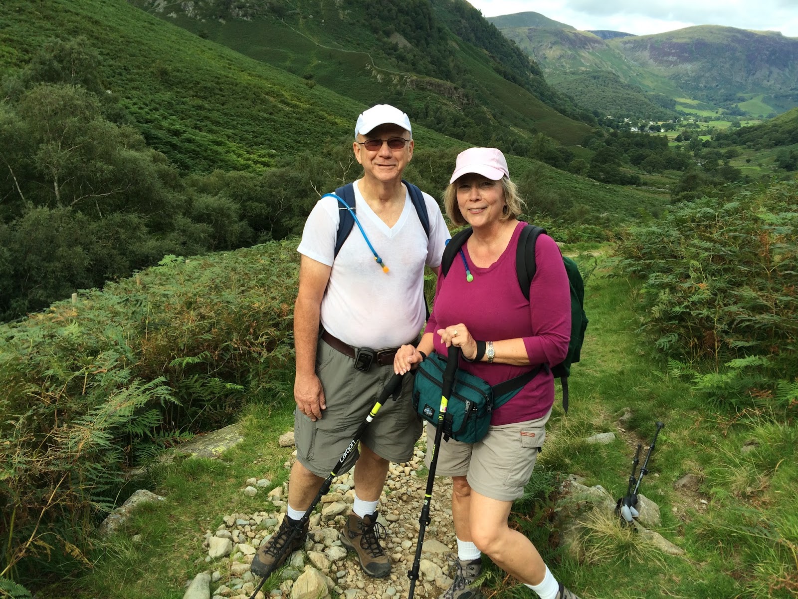
Sept 12 Reeth to Richmond 10.9 Miles
We awoke to a rainy day, our first. We brought the rain gear and were blessed to not need it until day 12. The Canadians bailed out today and took the bus.


Sept 13 Richmond to Brompton-on-Swale 6 Miles (Half Day Off)
The plan for the trip included a half day off here in Richmond. With only six miles to go, we could hang out all morning. We lounged at the B&B until 10:15 and then toured the Richmondshire Museum. It includes a room from the actual set of a beloved BBC TV series, All Creatures Great and Small about the life of veterinary doctor, James Herriot. We then walked around the square and had lamb baps (another new word), lamb on a bun with gravy and roasties. Richmond is built on the side of a very steep hill so some of the streets create challenging walking.


At the bottom of the hill we crossed the Swale river and looked back on Richmond. Based on the view from our window, it seems that our B&B must be in this picture somewhere.

As we walked through a forested area long the river, an unusual site caught our attention. A rather portly old gent was sunning himself in the nude. No pictures available.
We encountered a sign indicating that the route had been changed, directing us to turn right rather than go straight to a tunnel under a motorway. Norm could see on the GPS map that there was another trail leading to the tunnel, so we just took the turn to the right. Where the "other" path should have been, there was no sign of a path in any direction, but we were almost to a busy road that had a nice walking path. We needed to get under or over that motorway, and it seemed certain that this road would have a suitable bridge, so we followed the road. Soon another Coast to Coaster caught up with us and confirmed the tunnel is closed and for the foreseeable future we were on the official route. We passed a large construction site and saw the sign below. The English are so polite.

Almost as soon as we crossed the motorway, we arrived at the Farmer's Arms hotel. Our whole hike for the day took only 2:35.

Bonnie thought there might be too much pink in the decor of our room.

Information on our next B&B indicated that they would provide an evening meal if we just let them know the night before. Bonnie called. They had no record of our reservation and in fact had no reservations and were not in a situation to accept a reservation. The hostess said she would call Sherpa and get back to us. She could not reach Sherpa but she arranged for a room in a B&B which was on the route and within a mile of her B&B. If this had not been possible, and we had had to walk beyond her B&B, we might have had a 19 mile day! Total Miles 133.
Sept 14 Brompton-on-Swale to Danby Wiske 9.35 miles
We had a bit of unexpected exitement this morning when the fire alarm went off. Seemed to be a false alarm but the noise was piercing. We were walking by 9:05 anyway. We had entered the region of big farms. All the land was filled with live stock or was being tilled and planted. The stone fences were replaced with hedge rows and the stone houses were replaced with brick homes with tile roofs.

The tractors in England have huge front tires with allows them to drive on the highways at up to 45 MPH. Don't get in the way.


We had lunch on a bench just outside a church yard, in a tiny village. The sign on the back gate of the church indicated it was the farmers entrance. Presumably they could come to church in their work cloths and boots, if they used this entry.


We checked into our "last minute" B&B, the Ashfield House. This B&B turned out to fit the ideal profile; on the route and next to the pub. We expressed our gratitude for the last minute reservation many times. Total Miles 143.

 |
| Another story no doubt. |
Sept 15 Danby Whiske to Osmotherley 12 miles
It was raining when we awoke, as expected. It was supposed to clear about mid day so we hung around the B&B for an extra hour. We learned how our hosts got into the B&B business, why the husband will never to go American (too many guns), and why he'll never go back to Ireland (almost got in a bar fight). We took the opportunity to learn about the governments and history of Ireland and Northern Ireland. We never totally understood that.
We were walking by 10:10. We had to cross some active railroad tracks. Not sure if they were electrified. The trains in England are so quiet.


The other American couple started out even later than we did, but eventually passed us. We passed them while they had lunch on a bench. We pass them most days while they are sitting on a bench.


Getting to Osmothersley required the aforementioned climbing and then a steep descent. That would, of course, mean a climb first thing in the morning. The Canadians told us about a shortcut with a more gradual climb. When we arrived at the Golden Lion, the door was locked. Brief panic. We knocked not thinking anyone would be there, but the barman promptly welcomed us, OK'd the condition of our boots, and carried our bags up to our room. The Golden Lion had the best shower so far. Total Miles 154.

Sept 16 Osmotherley to Great Broughton 11.3 miles
We started at the same time as the Canadians, so although they walked a bit faster, we could follow them up the shortcut.


We reached the final pitch of the day after everyone else had disappeared. The route through the Wainstones was not at all obvious, but there was an obvious path to the left, carved into the hillside. We followed it until it went straight up an almost vertical face. We back tracked. A local fellow acted like he knew the route but fumbled around a bit and made no sound recommendation. Norm pioneered a bit and found the way.


At the bottom of the descent we met a road. Per prior arrangements, we were to phone Dave, our host. He would come and pick us up. All the B&B's were a couple miles off the route. First try? No reception. Now what? Wait a few minutes. Second try? Connection. Dave would be right up.
When we arrived at Dormonby Bridge Farm, the other American couple were lounging in the living room having tea. We were happy to have a cup and enjoyed our chat with Dave.


 |
| Teresa, Dave, Harold, Norm |
Dormonby Bridge Farm is more like a home than even the other B&B's. Bar of soap in the bath was no doubt there for the last guests too. Make your own toast, and tea, big jars of jam, just like at home. Make your own lunch (at no additional cost). When I settled the bill, I quoted the price Sherpa's site supplied. Dave said, no, and insisted on a lower figure.
Sept 17 Great Broughton to Blakey Ridge 8.8 miles
First half hour was up, up but, we were still on the Cleveland Way, so we had the nice paved trail.


When the ensuite was installed, the room had been divided in an interesting way. The bed room was so small, there was not enough floor space for us to open our bags and also walk around. Norm opened his in the roomy bathroom. Total Miles 175.


Sept 18 Blakey Ridge to Egton Bridge 11.7 miles
We awoke to find it was raining. This was a surprise. We waited around for about 15 minutes and then started. There were several people ahead of us but no one we knew. They all walked faster than we and we were alone for most of the day. On the moor again.


 |
| Another rare Coast to Coast sign. |


Today, two things happened for the first time. 1. We beat our bags to the hotel. 2. The actual mileage was LESS than Norm had estimated at the beginning of the day. On average we walked a mile more each day than the Sherpa web site and the books predicted. We weren't lost that much. Really.

 |
| View from the dining room |
The Canadians were staying at a B&B nearby. They ate at the table next to ours. Frasier asked if we knew about the shortcuts for the last day. It was looking like a 19 mile day, so we were very interested in shortcuts. Between Frasier's map and our Wainright guide, Norm learned the shortcuts. Total Miles 186.
Sept 19 Egton Bridge to Robin Hoods Bay - Final Day 12 miles
 |
| Come along and have a go |


 |
| Evidence of the 33% grade. |


The next leg was down a road with no shoulder at all. The tall grass grew right to the pavement. Cars were frequent but not going too fast, so we just stepped into the tall grass when they came up the hill. The English drivers are very courteous. The last mile was on sidewalks. We stopped for a cider at a pub in Thorpe.


Sept 20 Robin Hoods Bay 4.3 miles
All that remained was to walk down the hill and throw our pebbles into the North Sea and sign the book at the Wainwright Bar.


At the top of the hill we met Harold and Teresa. They had taken one more day off and so were just finishing up their walk. Great to see them again. We had one last cup of tea at the Victoria Hotel and then boarded the Sherpa Van for our ride to Darlington. Total Miles 203.
