The most recent issue of Michigan Trails Magazine shows, on the East Michigan Trail Guide page, that it seems possible to ride from Richmond all the way to Jackson on bike trails. I get interested when I find a long connection of existing trails. I wanted to see if it could be done and then actually ride from Richmond to Jackson. The total distance is approximately 110 miles.

This
ride covers
1.
Macomb
Orchard Trail (24 miles) - paved
2.
Clinton
River Trail (15 miles) - unpaved
3.
West
Bloomfield Trail (7 miles) - unpaved
4.
Michigan
Airlines Trail (7 miles) - paved
5.
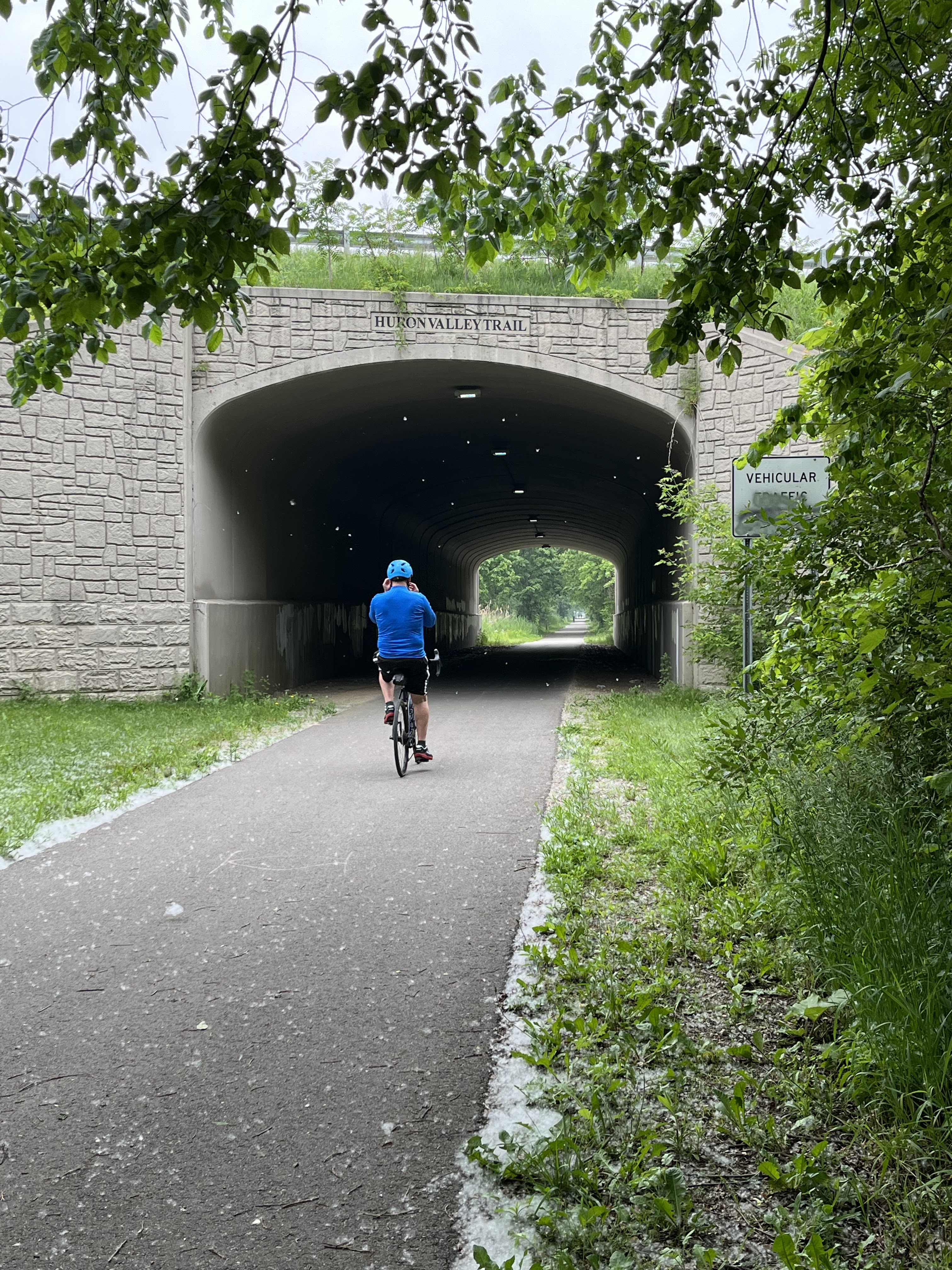
Huron
Valley Trail (about 3 miles) - paved
6.
I96
connector trail (3 miles) - paved
7.
Island
Lake State Park Bike Trail and road (7 miles) - paved
8.
US 23 Connector Trail (4 miles) - paved
9.
Whitmore
Lake Road (2 miles) - paved
10.
Mike
Levine Lakelands Trail State Park (42 miles) – 40% paved
My home is not far off the Clinton River Trail and it was most convenient to break the ride into two trips. My wife drove me to Richmond and I rode back to my home in Birmingham. This covered the entire 24-mile Macomb Orchard Trail which is wonderfully paved, and the first 6.5 miles of the Clinton River Trail.
This summer, 2025, there is a detour near the natural connection of the trails. If you are continuing on to the Clinton River Trail, it will be advantageous to follow the sidewalk on the North Side of 24 Mile Road. There is a serious CRT washout which will not be resolved for months or perhaps years. As of August 2025 no work has begun.

I did the remainder of the “century” in two consecutive days, spending the night at an Airbnb. I rode from my home and rejoined the Clinton Valley Trail at mile 6.5, completed the trails listed above through Island Lake State Park.
 |
| I96 Underpass |
 |
| I96 Connector goes off to the right just south of the underpass. |
The State Park has a bike trail from the Kent Lake Road crossing (east
end of the park) for about 3.5 miles.
One should leave the bike trail at that point.
 |
| Cross the grass to ride on the road. |
Join the road for the remainder of the State Park. The posted speed limit is 25 mph and traffic was
light even though it was a beautiful Saturday afternoon. The drivers were courteous to cyclists.
The
next morning, I rode the US 23 Connector, ducked under US23 at Silver Lake Road and then rode the two miles of Whitmore Lake Road,
which is quite smooth and has a 24-inch shoulder. Since it was early Sunday morning, there was
very little traffic. I did not feel
endangered by the few cars that passed me.
 |
| Beginning of the US23 Connector, leaving the state park. |
When you reach the M36 interchange, you have also reached the Mike Levine Lakelands Trail. Cross M36, look to your right. After the first few miles, there are no helpful mile markers. I believe the following
Gregory
– 18 miles
Stockbridge
– 23 miles
Hawkins
Road Trailhead – 38 miles
Cooper
Street end of the trail – 42 miles
Google
was useful for Gregory and Stockbridge but for some reason it did not believe I
could just stay on the trail all the way to Cooper Street. It wanted to route me onto roads, so it did
not give accurate distances as I approached Jackson. The trail is paved at the very end and goes
all the way to Cooper Street. Unfortunately,
there is not any parking at the end of the trail. The prison complex and the State Police Post dominate
the area. There is a nice trail head with
parking at the Portage River Railroad Bridge on Hawkins Road about 4 miles northeast.
The
easternmost 12 miles are paved. Most of
the rest of the trail is firm but unpaved.
Much of the trail passes through wetland, and marshes. There is plenty of nature. Much of the trail is shaded by large
trees. From Gregory west, there are plowed
fields. Beyond Stockbridge the farms
seem to be of a larger scale and there are more segments of the trail which are
unshaded.
 |
| Huron River Crossing near Hamburg |
 |
| Zukey Lake |
Of course the Paint Creek Trail joins the Clinton River Trail, and there is a connector between the Polly Ann Trail and the Paint Creek Trail, so similar trips could originate in Leonard, Oxford, Lake Orion or for the more adventuresome, from Dryden. In September, I started in Dryden and rode south to South Lyon. This trip involved the Polly Ann, Paint Creek Connector, Paint Creek, Clinton River, West Bloomfield, Airline, and the full length of the Huron Valley Trail. This ride was 70 miles. The web site for the Polly Ann Trail in Lapeer county indicates that it goes another 16 miles north from Dryden. This is no doubt true for horseback or hiking but it is just mown grass and would not be suitable even for mountain bikes.
The 110 mile of trails comprises most of the eastern end of the Great Lake-to-Lake Trails #1 envisioned to connect South Haven to Port Huron. Segments of the Great Lake-to-Lake Trails #1 are missing, and would require highway riding as of this writing. See https://ridewithgps.com/routes/48969156 for a map.
No comments:
Post a Comment